

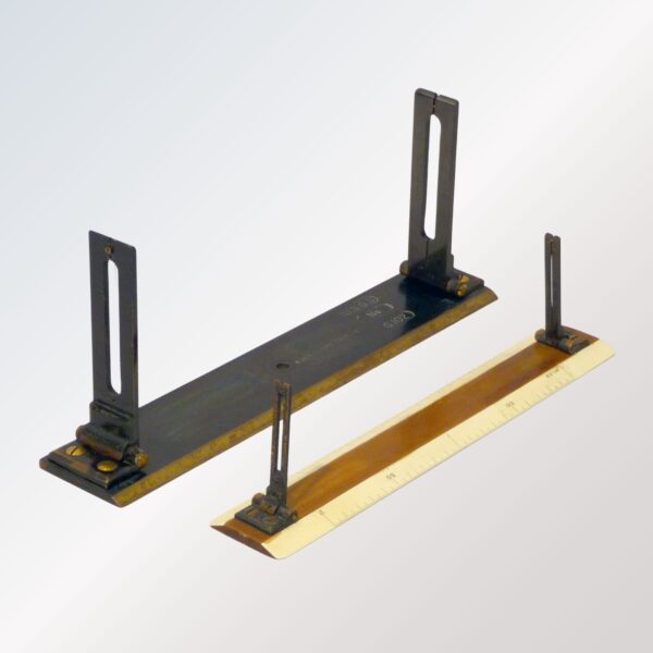
Description
The Plain Alidade is a traditional and reliable mapping instrument used for plane table surveying, topographic mapping, and field charting. Designed with a flat ruler and sight vanes, it enables accurate plotting of directions and angles on survey sheets directly at the job site. Its simple yet highly effective design provides fast alignment and smooth field operation for surveyors, civil engineers, and mapping professionals.
Constructed from high-quality corrosion-resistant material, the Plain Alidade ensures durability and precision in outdoor environments. With clear sighting capability and a stable drafting surface, it is an essential tool for basic plane table surveys and educational training in engineering institutes.
Key Features
Accurate directional sighting and mapping
Simple, lightweight, and durable structure
Corrosion-resistant metal scale for long service life
Smooth alignment for fast plotting on plane table sheets
Ideal for academic training and professional field surveys
Easy to carry and operate in remote field locations
Applications
Plane table surveying
Topographic and contour mapping
Educational training for survey engineering
Geological and site layout surveys


Reviews
There are no reviews yet.